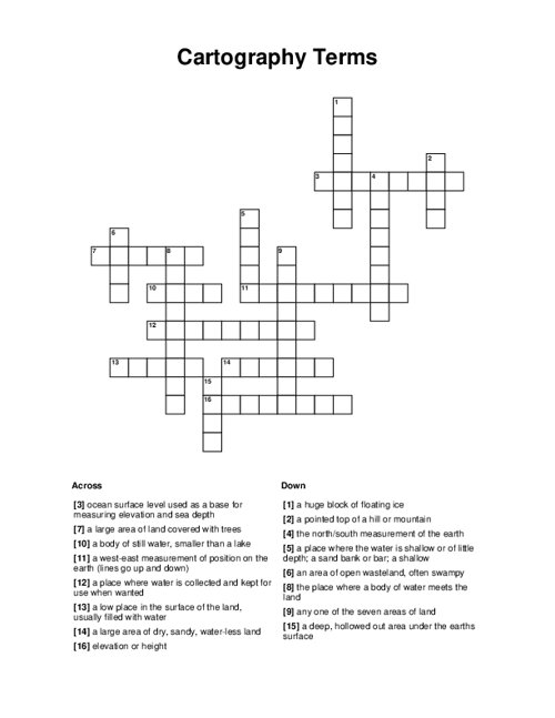
Cartography Terms Crossword Puzzle
Cartography is the study and practice of making and using maps and the art and science of graphically representing a geographical area, usually on a flat surface such as a map or chart.
Recommended: Check out this Advance Crossword Maker to create commercial use printable puzzles.
Title
Words List(answer : question or clue)
Shuffle questions
Font / Cell Box Style
Make sure to regenerate the puzzle to apply any changes.
Select an option:
Download Print
Try this another Crossword Puzzle Maker with different layouts.
Download will include unfilled worksheet and an answer key sheet.
Related Puzzles
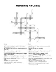
Maintaining Air Quality
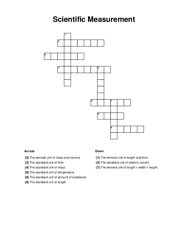
Scientific Measurement
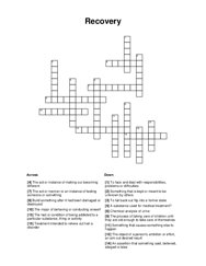
Recovery
Circulatory and Respiratory System
Nursing - Oxygen Delivery